|
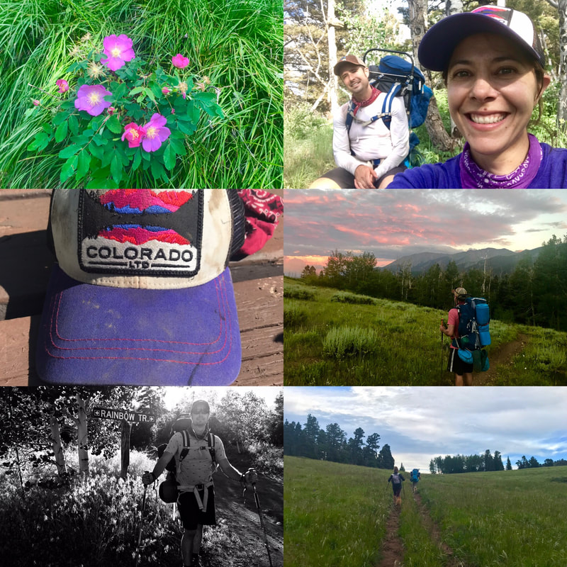
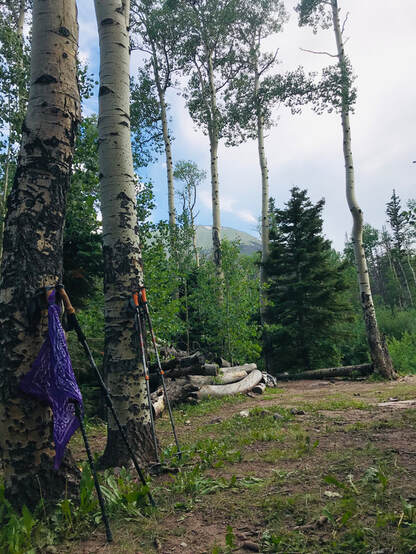
By Cat + Adam Jones 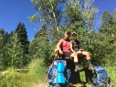 Hiking all 101 miles of Colorado’s Rainbow Trail this summer with my husband Adam was the one the most rewarding and challenging experiences of my life. Both of us having long been drawn to Colorado’s Sangre de Cristo mountain range—particularly the western side, where we’ve spent many a getaway hiking, fishing, hunting, and hot-springing in the San Luis Valley—the Rainbow Trail offered a fresh perspective of this majestic mountain range as it followed the eastern flank of the mountains, beginning at Medano Pass in the south and ending at Medano Pass to the northThe trail traverses over many diverse ecological areas, intersecting countless trails to high alpine lakes and historical spots. Outstanding views were only a part of it. Researching the trail online, there didn’t seem to be many accounts of backpackers doing the entire stretch all at once. We found a recent article from a few years ago about an ultra-runner who did the entire trail in about thirty hours (Wow!). Feeling no desire to beat this goal, we made it in six days, seven nights, averaging about 17 mi per day. Hiking during the rainy season of mid-July, we were very fortunate to have minuscule rainfall during the trip. We packed minimally, and only reluctantly brought a tent. This proved a wise choice in the end less because it protected us from rain but from the hordes of mosquitos, especially around the southern section of the trail. However, a vital piece equipment that didn’t last was our water filter, or, rather, the filter’s squeezable pouch. It was the first time we’d ever used this Sawyer Products Squeezable Pouch System, having purchased it as a lighter alternative to Adam’s trusty (but heavy) Katadyn pump filter. The actual filter itself was solid, it’s just that by the second day the glued seams of the squeezable pouch had begun to peel apart, spouting water everywhere until one of us would have to squeeze while the other attempted, more or less fruitlessly, to pinch together all the leaks By the last day this process required more than an hour to filter two Nalgene bottles and two CamelBaks. Next time, we will have more iodine tablets for back-up and get a different pouch. 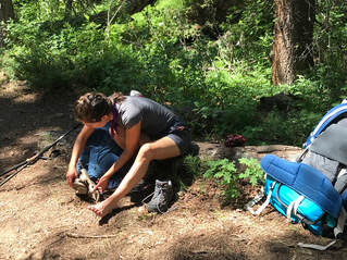 Tending to my feet became a necessary daily treatment. Tending to my feet became a necessary daily treatment. While our muscles acclimated within 48-hours, our feet never did. The amount of miles each day gave us both multiple blisters that would pop while hiking. The mole skin and sports tape we used to cushion each blow was a little too late. It was a test of will near the end to keep our feet going. Below are accounts of the different sections of the trail. It is highly recommended that you call the Forest Service ahead of time to check on all conditions and sections of the trail. The guidebook we used was the Falcon's Guide to Hiking Colorado's Sangre de Cristos and Great Sand Dunes. The book divided the Rainbow Trail into three sections: The guidebook we used was A Falcon's Guide to Hiking Colorado's Sangre de Cristos and Great Sand Dunes. The book divided the Rainbow Trail (RT) trail into three sections: I. Medano Pass to Hermit Pass II. Hermit Pass to Hayden Creek III. Hayden Creek to Poncha Springs 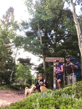 I. Medano Pass to Hermit Pass The beginning of the trail was reached from Forest Road (FR)412 via CR 111, which runs just south of Westcliffe, CO. This section of the trail is considered the most popular stretch of the trail. Unlike the northern section, the trail here is comparatively broad at 50 inches wide, allowing for ATV-riders as well as dirt bikes, mountain bikes, horses, and, of course, hikers. Here the hard-packed trail rolled gently through lush groves and swaths of pine, providing much-appreciated shade. Below and east of us sprawled the little mining towns and grassy ranch lands of The Wet Mountain Valley. The elevation gain was steady with many places to camp and plenty of water sources. And despite the obvious allure of this section, the trail never felt anything close to crowded. On the busiest day, a Saturday, we passed a couple ATVs, two men on horseback, and two different families out for day hikes. That’s it. The only annoying presence were the mosquitos. 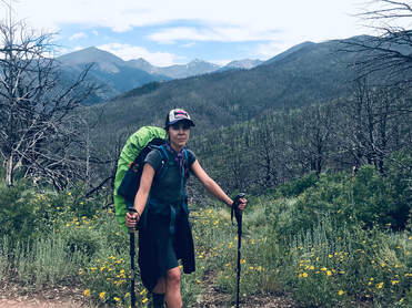 In the thick of being off the trail, surrounded by the burn scare. In the thick of being off the trail, surrounded by the burn scare. II. Hermit Pass to Hayden Creek This section of the trail was by far the most challenging. While there were still intermittent creeks to filter water, this stretch had more dry dirt, loose rock, and exposure which made the late-July much harder to ignore. The burn scar left from the forest fires in Fremont County five years ago stretched for dozens of miles. Vegetation and regrowth were evident in the area, although the charred trunks and sooty streambeds lent a somewhat eerie quality to the landscape. Between the rocky soil and the dense oak there weren’t many places to throw our tent down north of Ducket Creek trail head. Day two of this middle section was our toughest day. Winding through the remains of the fire, the trail grew faint, and it was soon evident that the path was no longer even being maintained. The big trouble awaited us at after Cottonwood Creek. Here we reached a sign warning us to proceed at our own risk as the trail had been rendered virtually non-existent by flash flooding through the burn scar. Our option at this point was to walk almost 20 miles along a county road to the town of Coaldale, and from there hike up to Hayden Creek, effectively circumventing the washed-out portion, or else, as the sign said, proceed at our own caution. Maybe it was for time’s sake or maybe it was the thought of not doing all of the trail, but we chose Option #2. 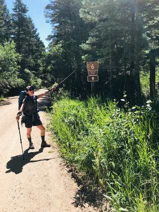 Striking forth along a deepening wash, the trail petered out about a quarter mile from Cottonwood Creek. At this point the Forest Service had turned to simply tying sporadic plastic ribbons to trees and brush along “path." These ribbons grew increasingly sparse as they led us through deep, flood-carved gulleys where the trail had (presumably) once been. These submerged and narrow pathways were littered with tumbled rocks, roots, and deadfall. Traversing through it was dangerous, especially as, for the first time along the trip so far, rain clouds began to form. With lightning flashing and thunder booming, we got into our rain gear just in time. The rain began to pour, and we hunkered low. Then within just 15 minutes or so of the storm starting, it was gone. With that, we resumed climbing hand over foot (literally) up the mountainside in hopes of gaining a vantage point for the trail. We kept a constant eye for the ribbons, even though they were often like finding needles in haystacks. Eventually though, and for no reason that we could see, the ribbons abruptly ceased. With no other alternative we scrambled down a gulch to make our way towards the closest landmark, the town of Cotopaxi. Scraped up, tired, and running out of water we discovered an old set of ATV tracks on what looked to be a private ranch road. Following the tracks led us to the ranch’s property line, and from there to a dirt road. Flagging the one car we saw, we confirmed the road was Colorado Highway 6 leading to Hayden Creek Campground, our destination for this very long day. The stranger was kind enough to drive us the few miles to the campground. She also informed us that because of the severe damage to the path the Rainbow Trail was going to be re-routed. This particular day on the trail also just so happened to bemy birthday. That evening we celebrated by cooking up our dinner and some apple-cinnamon oatmeal under our campsite’s picnic table as the rain once more began to fall. It was wonderful. 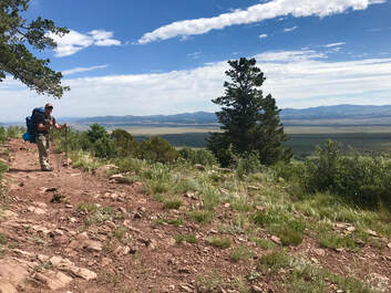 Overlooking the Arkansas River Valley. Overlooking the Arkansas River Valley. III. Hayden Creek to Poncha Springs Having survived the worst of the trail, everything north of Hayden Creek seemed easy. From here, the trail picked back up with vibrant green forest and a clear path. This became our favorite stretch with the aspens and columbines framing a stunning view of Arkansas River Valley below. This single-track section had some of most intense elevation gains, one of them the actual summit of Poncha Mountain 10,134 ft. The section around the Methodist Mountain Road was the most level part, although water sources, for the first time along the trip so far, became rather scarce. Our final day was emotional and gratifying. Our feet and joints ached with every step and rain clouds gathered all around us. After Poncha Mountain, we kept believing our car was just around the bend and only to be disappointed that it was not. We kept our spirits up and encouraged each other over more ascents and descents before we even saw a glimpse of Highway 285. A way to make the time go by was listening to music and audiobooks. Adam finished Jack London’s Star Rover, while I finished Miguel de Cervantes classic, Don Quixote. We screamed for joy the first time we saw the car nestled in between the mountains of Poncha Pass. The last ten steps of the trail we locked arms, determined to finish the way we started, together. A special guide was watching us across the road at the pass - a deer. We had seen deer throughout the trip a key moments, and took this as a good omen and well being. We had so many fantasies of food and beverage upon completion that we decided a large Dominoes Pizza with pepperoni and jalapeños would do the trick. Savoring each bite of the pizza, we relished how relieved we felt to not to having to contemplate where we would camp, filter water and how many many miles tomorrow would bring. The trip was finished and our hearts (and tummies) were full. This was a once in a lifetime trek opportunity. Although, the hike was all business, not enough time to stop and smell the pink wild roses. So next time, we will plan for less miles and go adventuring up one of the intersecting hikes along the RT for the future. My favorite part of this entire experience was that Adam and I did it together. Till the next adventure! Whatever you do, do with determination.
|
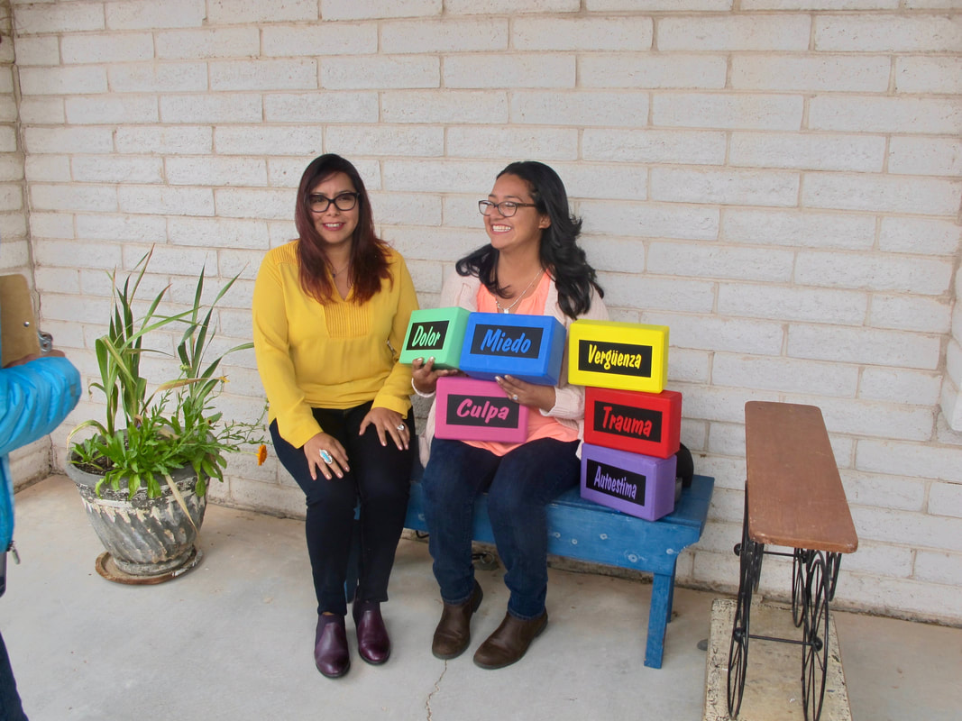
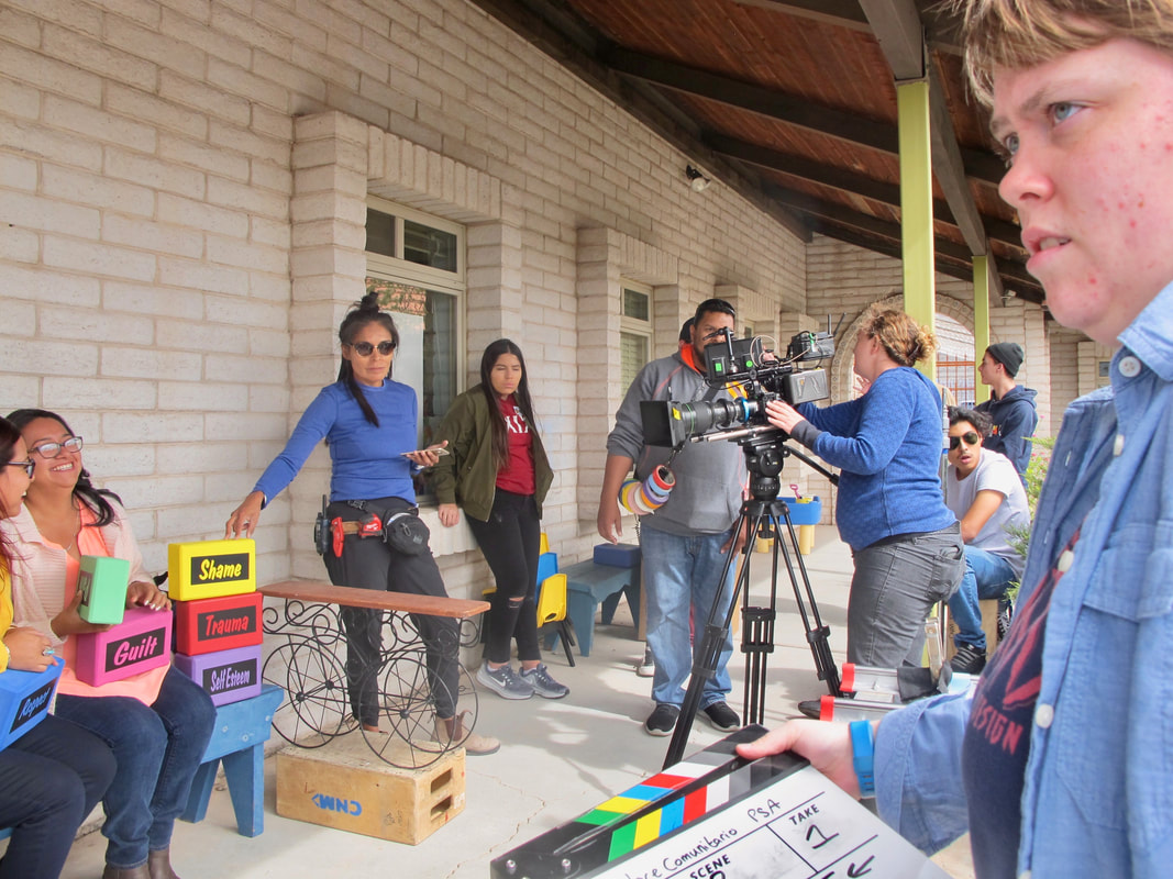
| Cat's latest film, OM+ME, took home the Audience Award at the New Mexico Filmmaker's Showcase 2018. From Cat, "My favorite aspect of this year's showcase is that the films were viewable online. The experience of sharing my films with so many people was a joy. Thank you New Mexico Film Office!" Watch trailer for OM+ME here. |
Cat is beyond honored to be selected as the official spokesperson for New Mexico-based non-profit Women 2 Be.
Many exciting events are coming to the 505 for Women 2 Be. I will be posting events and sharing opportunities to make a difference in girls and women's lives around the world. We are graciously accepting donations, please visit our website.
Women To Be's mission:
We distribute ‘kits’ of underwear and washable sanitary pads to girls who too often live with nothing.Access to underwear and sanitary pads contribute to girls’ overall health and success.Our ‘kits’ last up to three years! We also provide a sex ed class and a calendar to help avoid unintended pregnancy.
| The OM+ME team is so honored to be a part of the Las Cruces International Film Festival's 2018 Official Selection list. More screening details will be posted soon, check out their website for more details about passes and events: lascrucesfilmfest.com/ |
Meowza News
Bringing a little more Xanadu into the world.
Archives
August 2019
January 2019
November 2018
July 2018
June 2018
May 2018
March 2018
January 2018
November 2017
October 2017
September 2017
May 2017
March 2017
July 2016
June 2016
April 2016
February 2016
October 2015
September 2015
August 2015
July 2015
February 2015
December 2014
October 2014
July 2014
June 2014







 RSS Feed
